While looking for some remote sensing data last week, I ran into
spatial-analyst.net, which I think deserves the FE-website-discovery-of-the-month award. The wiki has pages dedicated to things like "
How to download and resample MODIS images". It's geared towards R users, and I'm kind of a Matlab guy, but it's still clearly useful to both parties. For example, I really like their
page pointing to various global datasets, some interesting examples of which are here:
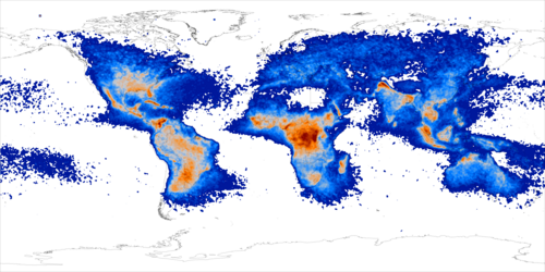 |
| Lighting flash rate |
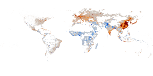 |
| Second principle component of recent population density changes |
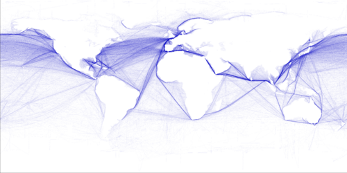 |
| Commercial shipping density |
 |
| Carbon density tones of C / ha. |
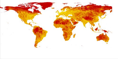 |
| Estimated travel time to major cities (>50k) in hours |
No comments:
Post a Comment